
July 01, 2019
(Geo)Designing solutions for the future of Yellowstone
World Campus graduate students in last semester’s geodesign studio applied what they are learning to help one of the nation’s most revered public sites
UNIVERSITY PARK, Pa. – When Penn State World Campus graduate students in the M.P.S in Geodesign program registered for the Rural/Regional Geodesign Challenges studio course (GEODZ 842) last semester, they were expecting to use the techniques they’ve been learning to address land-based challenges for a particular geographic area. What they were not expecting, however, was to apply their knowledge to help develop a large-scale recovery, restoration and sustainability plan for one the most iconic and revered sites in the United States, Yellowstone National Park.
“Getting to work with a real client, particularly one with the national prominence of Yellowstone, was a little intimidating; but it also provided us with a great opportunity to apply what we are learning to help that region survive and thrive,” said Joe Long, one of the students in the studio course.
Long, who earned his bachelor’s degree in landscape architecture from Penn State in 2018 and is now pursuing master’s degrees in both geodesign and landscape architecture, continued, “We were working with a national park area with a ton of history associated with it, and we had to create a design solution that could help maintain and enhance its natural beauty all while looking to the future growth of the area. That made for a design process that had to be well-thought-out and comprehensive.”
What is geodesign?
The widely-accepted definition of the term first appeared in Carl Steinitz’s 2012 book, A Framework for Geodesign: Changing Geography by Design. Steinitz, the Alexander and Victoria Wiley Professor of Landscape Architecture and Planning, Emeritus at Harvard University’s Graduate School of Design, defined geodesign as “…a set of concepts and methods to get all stakeholders and different professions involved … to collaboratively design and realize the optimal solution for spatial challenges in the built and natural environments, utilizing all available techniques and data in an integrated process.”
Geodesign’s central tenets – including immediate feedback, collaborative decision-making and assessing site performance and conditions – influence all parts of the workflow when designing a site.
“The need for resilient and sustainable built and natural environments increases daily,” said Kelleann Foster, lead faculty for the Penn State geodesign program and a professor in the Department of Landscape Architecture. “Geodesign is rooted in transparency and real-time engagement. It is a contemporary take on planning and design that is making a difference worldwide.”
The connection
Shannon McElvaney, the instructor of the online geodesign studio, first met the founder and director of the Yellowstone Ecological Research Center (YERC), Bob Crabtree, several years ago when McElvaney was writing his book, Geodesign: Case Studies in Regional and Urban Planning. A few years later they bumped into each other at the Geodesign Summit and shortly after that, Crabtree reached out to McElvaney – who had since joined Penn State – to let him know that he’d like to use geodesign for a problem he was having in Yellowstone.
McElvaney mentioned the graduate-level studio course he was teaching and so began the partnership between Penn State and the iconic national park.
The project
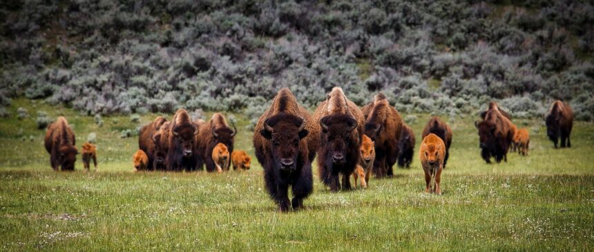
Crabtree explained that due to climate change and other environmental issues, the animals that YERC had been working so diligently to protect over the years were heading north to Paradise Valley, Montana, which is just beyond the boundaries of Yellowstone National Park. The area is home to many ranchers and, with its picturesque valley views and bounty of trout for fly fishermen, is also known to attract high profile residents and guests – including Hollywood actors and producers, musicians and wealthy businesspeople – all looking for a respite from their busy lives in metropolitan areas.
The scenario playing out in Yellowstone and Paradise Valley, which is located in Park County, Montana, is problematic for the animals, ranchers, area residents/visitors and the local government.
The solution to the region’s challenges, believes Crabtree, is to develop a long-term plan for both the restoration and recovery of the park’s natural communities, and for the sustainability of the human population in the area.
“Basically, Yellowstone and regional officials want to create a place where both people and wildlife can coexist,” said McElvaney. “That’s what this studio class was focused on creating as a team – a proposed plan for Northern Yellowstone using concepts within the geodesign framework.”
The steering committee
The members of the steering committee for the project represented different stakeholders that would be affected by any new measures that are introduced in the region. The students spoke with each of the members of the committee via video conferencing and had the opportunity to hear each of their concerns about the area, as well as any ideas they had to work toward a resolution that would satisfy everyone.
Along with Crabtree, a field ecologist and quantitative biologist who is looking out for the land, animals and plant life of Yellowstone, the steering committee consisted of:
- Michelle Uberuaga, executive director of the Park County Environmental Council, who leads the community-based conservation group in Yellowstone's northern gateway and brings an understanding of the threats on the environment – both from climate change and water scarcity – to the table. She is mindful of the issues county residents face in terms of affordable housing and cost of living, and also the conflict ranchers in the area deal with as animals head onto their land.
- Michael Inman, planning director for Park County, who is responsible for the long-term planning, community development and economic development of the county. He is concerned about the residents, visitors and local businesses who are affected by animals wandering into roadways. He is also dealing with the rising demand for utilities and roadways in the area.
The team
One would think that being located in different areas of the country – and in one instance, a different region of the world – would make working as a team on a project of this scale impossible. But, thanks to the ever-evolving world of communications and technology, graduate students in the online studio were able to approach the project as they would any other team effort in an in-residence school setting or workplace. The team had weekly discussions in Penn State’s online platform during the 15-week course and were able to apply their individual expertise to help the overall team effort.
One of the biggest assets of this project, said McElvaney, was the diversity of the class. As a graduate-level course, each student has a unique background and their own strengths to offer.
“Joe (Long), with his background in geographic information systems (GIS), was able to step up when we were doing some land-use analyses. He completed the site suitability work that was then used by everyone on the team,” said McElvaney. “We also had one student with a lot of experience in environmental planning, another who had done a lot of work with facilities and public planning, and yet another with experience in food deserts and food banks. We had a great mix of students with different talents, backgrounds and points of view but they all pulled together for the good of the team, just like any collaborative unit in a work environment.”
The challenges
According to both McElvaney and the students, the sheer size and scope of the region was the most challenging aspect of the project.
“There’s the issue of human-animal conflict between species and the ranchers and residents as elk, bison, grizzlies and the occasional wolf roaming north. There are also environmental issues that are the result of the construction of new residences in subdivisions on land in Paradise Valley that was previously prairie land, including stormwater runoff,” explained McElvaney. “Add to that the strain on residents as demand forces the cost of living to increase, plus the pressure the government is facing to establish an infrastructure that supports the utilities and roadways of the new communities, and you have quite the complicated problem on your hands.”
Long agreed, adding that the amount of data the team had to filter through seemed endless.
“Due to the size of the area and the various stakeholder concerns, we had a lot to address and a lot to process,” he commented.
The solution
When asked about some of the most memorable contributions of the student’s work, McElvaney points to two in particular.
The first came from Celi Cho, a graduate student based in Belize. One of the tenants in geodesign is to design with an intent and purpose that encompasses physical, temporal, conceptual and/or relational relationships. Cho used the idea of the spatial and the temporal relationships of the area by submitting that ranchers allow cattle to use the prairie land in Park County during the summer months and then allow the bison and elk use it in the winter, when they need the grasslands.
“I know a lot of the animals are being sold off to slaughter so it just makes good sense to share that land,” said McElvaney.
The second concept was designed by Andy Belcourt, a long-time environmental planner, archaeologist and GIS analyst who lives in Los Angeles. Belcourt looked at the Yellowstone River, which flows through the area and is home to an abundance of trout. It is also the only continuous undammed river in the United States.
Many people come to the area for the trout fishing, which provides a great economic boost in the region; however, due to gray infrastructure (e.g., cement construction) currently being used to slow down runoff stormwater, water pollution becomes an issue. This, of course, poisons the trout people come to catch and can affect the health of those who eat the affected fish.
In Belcourt’s design, he proposes planting willow in the river. Willow is known to attract beavers which eat the willow and also use it to build dams. In the process of building the dams, the beavers are also replanting the willow which then produces ponds that both slow down the flow of water and provide a home for the baby trout.
“Andy used a natural process – beavers building dams – to reengineer the water system in the area. This reduces stormwater runoff and thus eliminates the extreme health risks to the trout, the people eating the trout and the economy,” said McElvaney.
The feedback and next steps
McElvaney submitted the class’s recommendations to Crabtree, Inman and Uberuaga. The steering committee is reviewing the scenarios and there are plans to take this project forward with additional stakeholder involvement. Utilizing the geodesign framework has provided a transparent and open record of the process for the steering committee to use throughout the next steps.
As for the students, they agree that the experience was an invaluable learning opportunity they will not soon forget.
“I couldn’t have gotten this kind of experience anywhere else,” said Michael Cullen, a geodesign graduate student who lives in Shreveport, Louisiana. “It was a real privilege to work on this project from a cross-systems approach and it was insightful to know that as graduate students, we could provide a value-added analysis that the ‘experts’ might not have considered otherwise.”
Geodesign at Penn State
Penn State offers two graduate options in geodesign through the World campus, the M.P.S. and a graduate certificate. Those enrolled in the Master of Geographic Information Systems online program can also select geodesign as an option.
The programs were developed by the Stuckeman School with input from the Department of Geography and an international advisory board comprised of geodesign experts.
